 TrainAtlas
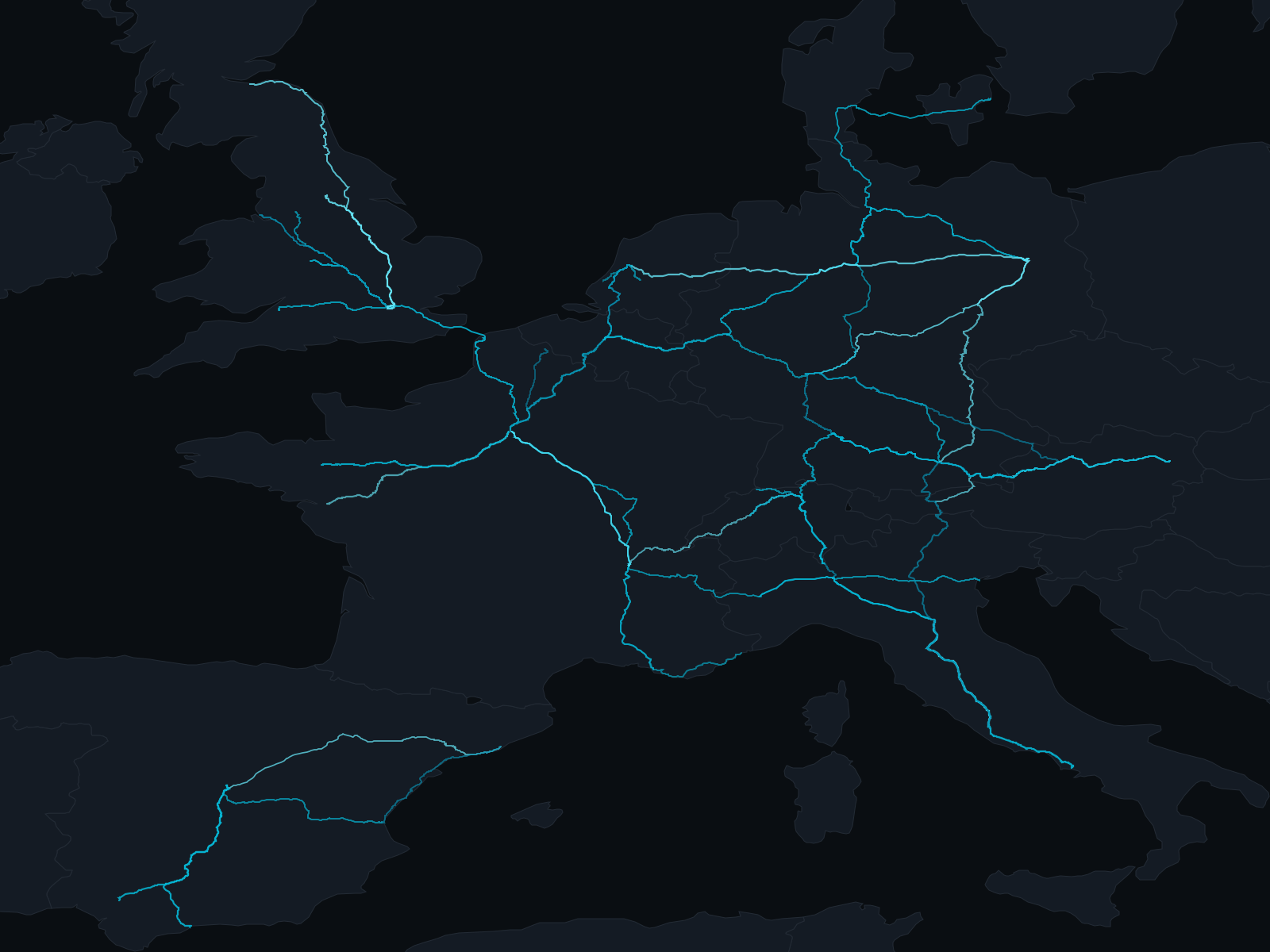
Flights have boarding passes. Road trips leave photos and pins. Train journeys are strangely easy to lose.
You may remember the night train to Vienna, the first Eurostar you took or the branch line that carried you into the Highlands. But after enough journeys, the dates blur, the distances disappear and the route itself becomes difficult to reconstruct.
The simplest way to map your train journeys is to keep a rail-specific travel log with the origin, destination, date and actual railway route for every trip. A spreadsheet can preserve the basic record. A dedicated train journey tracker can turn that history into a map that grows with every line you ride.
This guide explains what to record, how to rebuild older journeys and how to avoid a map made of misleading straight lines.
What a useful train journey map should show
A good rail travel map needs more than two pins joined together. At minimum, each journey should include:
- The station where you boarded
- The station where you left the train
- The date of travel
- The train operator or service, where known
- The railway line the train actually followed
The last point matters more than it may appear. Trains do not travel directly between coordinates. They follow valleys, curve around coastlines, pass through junctions and sometimes cross a border that a straight line would miss entirely.
Accurate route geometry makes the finished map recognizable. It also produces more meaningful distance, country and operator statistics.
Three ways to map your train journeys
1. Keep a spreadsheet
A spreadsheet is the simplest place to begin. Give each row a date, origin, destination, operator and train number. It is portable, easy to back up and flexible enough for unusual journeys.
The limitation is the map. A spreadsheet records what happened, but it does not automatically draw the route. Turning hundreds of rows into an accurate railway map usually means finding coordinates, matching stations and routing every journey yourself.
This method works well if you mainly want an archive or already have years of journeys in CSV format.
2. Use a general travel map
General travel trackers are good at remembering cities, countries and complete holidays. Some can draw movement between places or build a photo journal around a trip.
They are less useful when the train itself is what you want to remember. A general tracker may connect Paris and Zürich as two destinations without knowing whether you travelled through Dijon, Strasbourg or another route. It may also mix trains with flights, drives and walks.
Choose this approach if the whole holiday matters more than the railway details.
3. Use a train journey tracker
A dedicated train journey tracker treats the train as the subject, not merely the transport between two places. It can search railway stations, retain service details, follow railway geometry and build statistics around the lines and operators you have travelled.
This is the most practical choice if you want a map of the trains you have taken rather than a general map of everywhere you have visited.
A straight line between two stations is not your journey.
How to build your rail travel map
Start with journeys you remember clearly
Do not begin by reconstructing your entire life on rails. Start with the journeys from your most recent trip, a regular commute or a route you know well.
Recording ten reliable journeys is more useful than adding a hundred guesses. Once the structure is in place, older trips become much easier to add.
Record the essential details
For each journey, capture the origin, destination and date first. Add the operator, train number, departure time and intermediate stops when you know them.
If an old ticket or email confirms a detail, use it. If it does not, leave the uncertain field blank rather than inventing precision. A trustworthy travel history should distinguish between what you know and what has been reconstructed.
Follow the railway, not a straight line
Two maps can contain the same stations and tell completely different stories.
A straight segment between London and Paris cuts across the landscape. The railway journey runs through Kent, the Channel Tunnel and northern France. Zürich to Milan is not a diagonal across the Alps. The route bends through valleys and tunnels before reaching northern Italy.
When choosing a mapping tool, look for one that follows railway infrastructure and clearly identifies an approximate route when the exact service shape is unavailable.
Add older journeys in batches
Once recent trips are mapped, work backwards in manageable groups:
- Export journeys from any tracker you already use.
- Search old booking emails and calendar entries.
- Check tickets saved in Apple Wallet, Photos or cloud storage.
- Group trips by year, holiday or regular route.
- Import a CSV where possible instead of entering every journey again.
You do not need to complete the map in one sitting. A personal rail atlas is more satisfying when it fills in gradually.
Review routes that look wrong
Railway data is not equally detailed everywhere. A historic trip may have several plausible routings, and an unusual diversion may differ from the normal line.
If a route looks implausible, check the stations and date first. Then look for an intermediate stop, ticket, timetable or journey note that identifies the correct path. Keep the route marked as approximate when the evidence is incomplete.
Decide how private the map should be
A complete train journey map can reveal where you live, where you work and when you travel. Treat it as location history, not just a decorative map.
Before choosing a service, check whether it requires an account, whether journeys are stored on someone else's servers and whether sharing is public by default. A private map should remain private until you deliberately export or share something.
How to map train journeys with TrainAtlas
TrainAtlas is a native iPhone app built for keeping a personal map of the trains you have taken.
- Open the Map and tap Add Trip.
- Choose an operator or search across all trains.
- Select the origin, destination and travel date.
- Pick the service that matches your journey.
- Review the route and tap Save Trip.
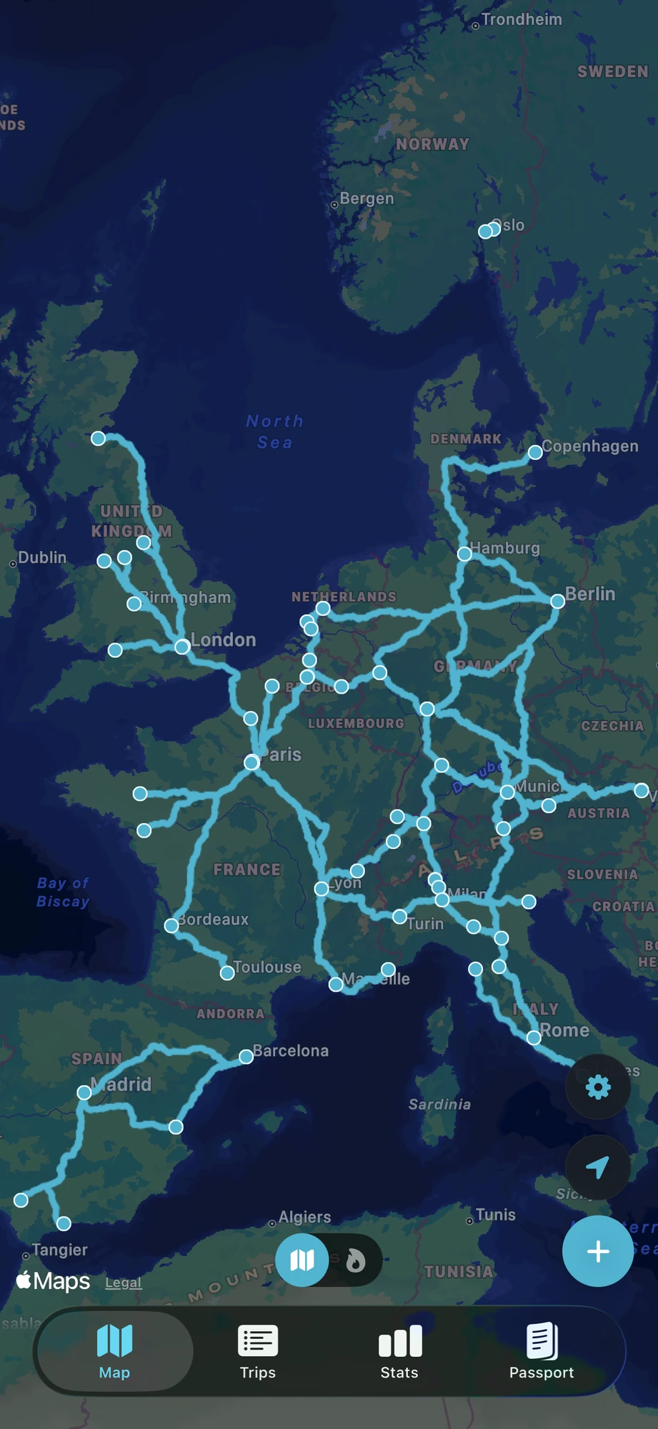
The new journey reveals itself on your map along the railway route. When an exact service shape is available, TrainAtlas uses it. When only an approximate rail route can be established, the app labels it accordingly instead of presenting an estimate as exact.
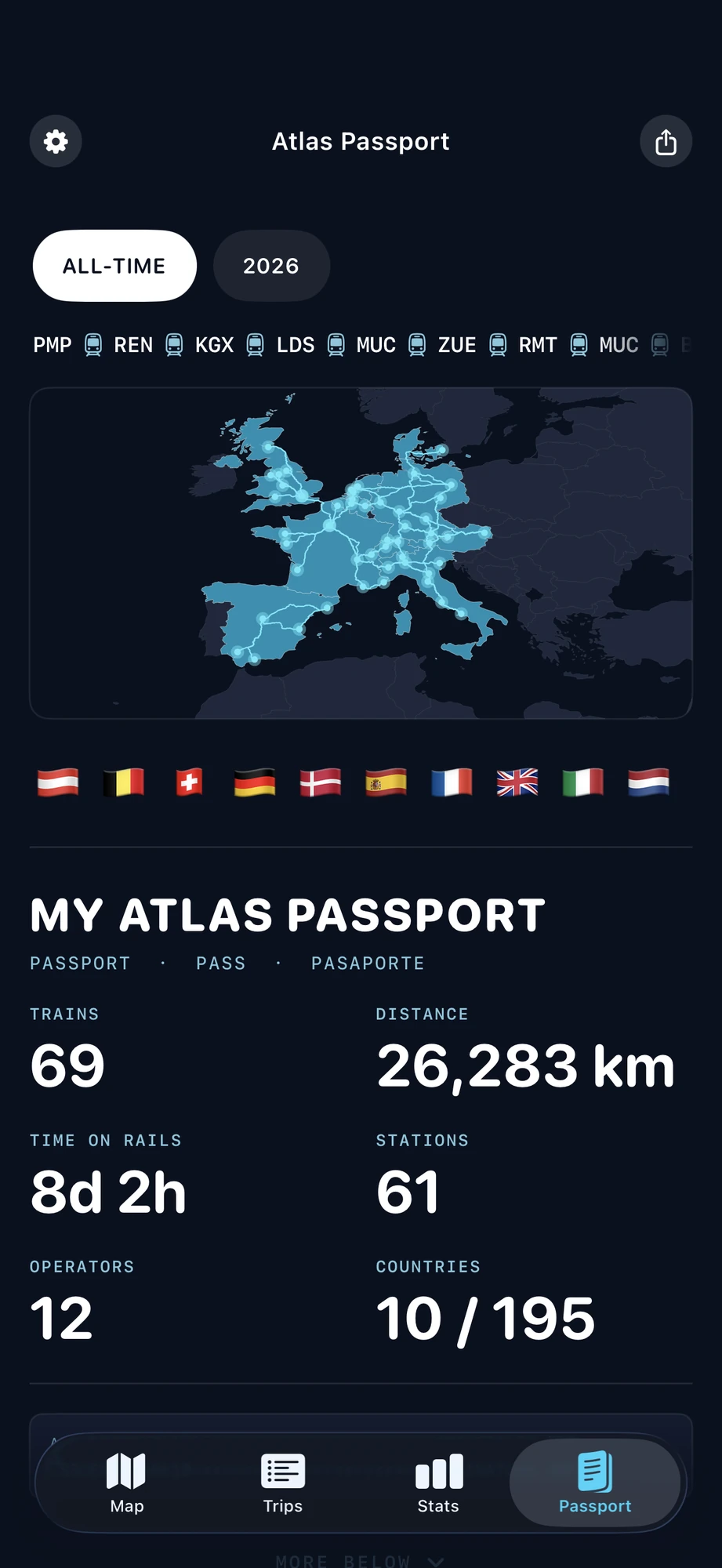
As the map grows, the Atlas Passport turns the same journeys into a record of countries, distance, time aboard, operators and personal milestones. Map Replay can play a single journey or a larger travel history back across the map.
Start with one journey.
Watch your personal rail map begin to fill in.
Bring an existing history with you
If you already track your journeys elsewhere, you do not need to start again. TrainAtlas can import:
- viaduct.world CSV exports
- TrainLog CSV exports from trainlog.me
- Trainline Fares and Fare-Legs data exports
- A general CSV or spreadsheet with recognizable origin, destination, date and time columns
The import preview shows which journeys are ready, which are duplicates and which need attention before anything is added. Imported trips then use the same station matching and route-building system as journeys added in the app.
TrainAtlas Free supports trips from the last 12 months onward. If you want to reconstruct a complete history that goes back further, full back-history is included with TrainAtlas Pro.
What can you learn from a complete train journey map?
The map is the obvious reward, but the history behind it becomes more interesting over time.
You can see which countries and operators define your travel, how far you have travelled by rail and which routes you return to most often. A collection of isolated trips becomes a connected network. Familiar corridors grow brighter while gaps suggest the next journey.
Most importantly, the record belongs to you. It is a way to remember the ordinary trains as well as the exceptional ones: the commuter service you rode for years, the missed connection that became an adventure and the local branch line that completed a much larger trip.
Frequently asked questions
Can I map train journeys I took years ago?
Yes. Add them manually using the stations and date, or import an existing CSV history. Old tickets, booking emails, calendar entries and photos can help confirm the details. TrainAtlas Free supports trips from the last 12 months onward, while Pro supports a full back-history.
Can I import journeys from Trainline, TrainLog or viaduct.world?
Yes. TrainAtlas recognizes viaduct.world and TrainLog CSV exports, as well as Trainline Fares and Fare-Legs data exports. It can also read a general CSV with suitable station and date columns.
Does a train journey map follow the actual railway line?
It depends on the tool. Some travel maps simply connect the origin and destination. TrainAtlas uses railway-following geometry and clearly labels an approximate rail route when an exact service shape is unavailable.
Do I need an account to use TrainAtlas?
No TrainAtlas account or sign-up is required. Your journey history is stored on your iPhone. If you choose to enable iCloud sync, it is stored in your private iCloud account so it can remain available across your devices.
Can I share my train journey map?
You can create Atlas Passport share cards for your travel statistics and milestones. Sharing is deliberate: your full journey history is not made into a public profile by default.
Start with one journey
Choose a train you remember well. Add the stations, find the route and watch the first line appear. Then add another.
You do not need a perfect archive on day one. The pleasure is in seeing the map become yours, one railway at a time.
Map your first train journey.
TrainAtlas is available for iPhone.